Volcanic eruption preparedness
Educational use only
This page is for educational purposes only. Hands-on skills should be learned and practiced under qualified supervision before relying on them in emergencies. Use this information at your own risk.
Most volcanic eruptions do not produce the explosive, cinematic catastrophe that dominates popular imagination. What they reliably produce — in events large and small — is ash. Fine volcanic ash covers crops, collapses roofs, damages engines, contaminates water supplies, and causes serious respiratory harm. Understanding which volcanic hazards require evacuation versus which require shelter-in-place is the core planning decision for anyone living within range of an active volcano.
The 1980 Mount St. Helens eruption in Washington State collapsed a 1,300-foot (400-meter) peak in seconds and generated pyroclastic flows that destroyed 230 square miles (596 square kilometers) of forest. The 1991 eruption of Mount Pinatubo in the Philippines ejected so much material that global temperatures dropped measurably for two years. Both events gave scientists enough pre-eruption warning to enable significant evacuations — because volcanoes, unlike earthquakes, almost always signal activity before a major event.
Eruption types and what they produce
Not all volcanic eruptions behave the same way. The type of eruption determines the hazards you face, the warning time you receive, and the distance you need to put between yourself and the volcano.
Hawaiian eruptions are the most benign in terms of immediate human hazard. They occur when low-viscosity basaltic lava flows from vents or fissures with relatively little explosive force. Lava flows in open terrain typically move at 1–6 mph (2–10 km/h) — fast enough to cross a neighborhood in hours, slow enough to allow organized evacuation if you leave early. The primary danger is not being caught by the flow itself, but waiting too long. The 2018 Kilauea eruption in Hawaii consumed over 700 homes and 13.7 square miles (35 square kilometers) of land through slow lava advance that communities tracked but underestimated until evacuation windows closed.
Strombolian eruptions involve moderate, rhythmic explosions that eject glowing clots of lava hundreds of meters into the air. They generate significant amounts of scoria (cinder) and lapilli (small rock fragments) that rain down around the vent. The primary hazards are ballistic impacts near the vent, ongoing ashfall, and the possibility of escalation to a more explosive phase. These eruptions can persist for months or years with intermittent activity.
Plinian eruptions are the most dangerous eruption type. Named after Pliny the Younger's account of the 79 AD Vesuvius eruption that buried Pompeii and Herculaneum, Plinian events generate enormous eruptive columns — sometimes reaching 45 km (28 miles) into the stratosphere. They produce massive ashfall over wide areas, pyroclastic density currents, and can trigger lahars and tsunamis. The 1991 Pinatubo eruption was Plinian; its ash cloud circled the globe and deposited measurable ash across Southeast Asia. These are the events where distance measured in tens of miles is the only protection.
Phreatic eruptions (also called steam eruptions) occur when magma near the surface or hot volcanic gases heat groundwater to the boiling point. The resulting steam explosion ejects existing rock rather than fresh magma. Their defining characteristic is unpredictability — phreatic eruptions can occur with almost no seismic warning. The 2014 eruption of Mount Ontake in Japan killed 63 hikers with a phreatic explosion that gave only seconds of warning. These eruptions can happen at volcanoes considered dormant or in quiet periods between major eruptive phases.
Phreatic eruptions have almost no warning
If you are hiking near or on a volcanic crater, pay attention to any sudden ground shaking, intensifying sulfur odor, or changes in steam venting. Designated exclusion zones around active vents exist for this reason — respect them even when the volcano appears quiet.
The USGS alert level system
The US Geological Survey Volcano Hazards Program uses a two-tier notification system for US volcanoes:
Volcano Alert Level (hazard to people on the ground):
| Level | Meaning |
|---|---|
| Normal | Background, non-eruptive activity |
| Advisory | Elevated activity above background, monitoring ongoing |
| Watch | Eruption likely, or eruption occurring with limited hazards |
| Warning | Hazardous eruption imminent, underway, or suspected |
Aviation Color Code (ash hazard to aircraft):
Green → Yellow → Orange → Red, with Red indicating significant ash emission is imminent or underway.
When the alert level changes, the USGS issues a Volcano Activity Notice (VAN), which is distributed through the USGS website and National Oceanic and Atmospheric Administration (NOAA) Weather Radio. Subscribe to email or text alerts for any volcano within range of your location through the USGS volcano notification service. For the Pacific Northwest, Alaska, and Hawaii, this is not a theoretical precaution — these regions contain some of the most active volcanoes in the world.
When to act based on alert levels:
- Advisory: Monitor the situation. Review your evacuation plan and confirm your go-kit is stocked.
- Watch: Prepare to leave. If you have livestock or mobility limitations, consider pre-evacuating before roads become congested.
- Warning: Execute your evacuation plan now. Do not wait for the eruption to begin — roads near a Warning-level volcano fill rapidly. Leave at the Watch stage if you have any reason for concern about your evacuation window.
Evacuation orders based on alert levels are issued by local emergency management, not the USGS. The USGS characterizes the hazard; county officials issue the orders. Know your county's emergency alert subscription system.
Pyroclastic flows: no shelter, only distance
Pyroclastic flows are superheated mixtures of gas, ash, and rock fragments. They travel outward from a volcanic vent at average speeds of roughly 60 mph (100 km/h), with some flows reaching 430 mph (700 km/h) on steep flanks. Temperatures exceed 1,500°F (815°C). They follow topography — flowing down valleys and drainages — but their speed makes topographic escape on foot impossible once a flow begins.
There is no shelter that protects against direct pyroclastic flow impact. If you are inside a pyroclastic flow hazard zone when an eruption generates a flow, you will not survive in a structure. The only protection is being outside the hazard zone before the eruption. This is not a statement about gear or shelter quality — it is a physical constraint. The residents of Pompeii were not killed for lack of preparation; they were killed by remaining inside a hazard zone during a Plinian eruption.
Pyroclastic flow hazard maps are published for all major US volcanoes by the USGS. The hazard zones are drawn conservatively — they represent the area at risk from the plausible worst-case event, not every eruption. For Cascade Range volcanoes (Rainier, Hood, Shasta, Baker, and others), these maps are available through the USGS and state geological surveys.
Lahar zones extend far beyond eruption zones
Lahars are volcanic mudflows — slurries of volcanic material and water that can originate from eruption-triggered snowmelt, crater lake displacement, or heavy rain on ash-covered slopes. They move at speeds up to 30 mph (50 km/h) and have the density of wet concrete. During the 1980 Mount St. Helens eruption, lahars traveled 17 miles (27 km) down the North Fork of the Toutle River. Lahar hazard zones extend far downstream from volcanoes into populated river valleys — many people who live nowhere near a volcano are in lahar paths. Check Washington State DNR, Oregon DEQ, and USGS for lahar inundation maps specific to your watershed.
Lahar-specific planning
Lahars travel in river valleys. If you live downstream from a glaciated or crater-lake volcano — including the Cascade Range peaks — check whether your home or evacuation route crosses a lahar path. Mount Rainier sits above the Puyallup, Nisqually, and White River valleys; populated communities including Orting, Washington, lie in a direct lahar path where a major eruption could send flows reaching town within 30–40 minutes.
- Plan evacuation routes that move perpendicular to river valleys, not along them.
- A lahar sounds like a fast-approaching river and carries a strong sulfur smell. Rising, muddy water in a normally clear river channel is an early indicator.
- Do not attempt to cross a lahar flow on foot or in a vehicle. The density of the slurry is far greater than water and will sweep vehicles off roads.
Volcanic ash: the widespread hazard
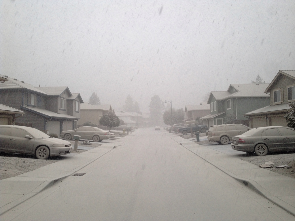
Ashfall affects a far larger area than any other volcanic hazard. The 1980 Mount St. Helens eruption deposited ash across 11 states. The 1991 Pinatubo eruption deposited measurable ash across Southeast Asia and circled the globe in atmospheric suspension.
Ash particle sizes range from blocks and lapilli (visible chunks) to fine ash smaller than 0.1 mm — particles small enough to penetrate deep into the lungs and remain lodged there. Fine volcanic ash is not soft like wood ash; under a microscope it is sharp, glassy, and abrasive. It is also mildly acidic.
Health effects of ash exposure:
- Fine particles (PM10 and smaller) penetrate the bronchial tree; prolonged exposure causes respiratory distress, asthma exacerbation, and silicosis-like damage in extreme cases
- Eye irritation and corneal abrasion from airborne particles
- Skin irritation, particularly with prolonged contact
Minimum respiratory protection: N95 or P100 respirator. The CDC and IVHHN (International Volcanic Health Hazard Network) specify NIOSH-approved N95 masks as the minimum standard for ash exposure outdoors. Standard dust masks and surgical masks do not filter particles fine enough to be protective. A P100 respirator provides higher filtration efficiency and is preferable for heavy ashfall. Cloth masks offer essentially no protection against volcanic ash. Keep N95 respirators as part of your volcanic ash kit — they are inexpensive, available at hardware stores, and have a shelf life of years in sealed packaging.
Goggles that seal against the face (not just safety glasses) protect the eyes. People with contact lenses should switch to glasses during ashfall — ash under a contact lens causes corneal abrasion.
Roof loading from ash accumulation is a serious structural hazard. A dry layer of volcanic ash 4 inches (10 cm) thick weighs 120–200 pounds per square yard (65–110 kg per square meter). Wet ash can weigh twice as much. Most residential roofs are designed for snow loads, which a wet ash accumulation can exceed. Flat and low-slope roofs are most vulnerable; steeper-pitched roofs shed ash more readily. Ash accumulation of 4–8 inches (10–20 cm) on a flat roof during rainfall is enough to cause structural failure.
Field note
Brush accumulating ash off flat roof surfaces early and often — do not wait for it to consolidate. A dry layer is manageable with a soft broom; once rain saturates it, the weight increases dramatically and removal becomes hazardous. For a home with a low-slope or flat roof in a potential ash zone, pre-position a soft broom and an N95 supply in the garage before ash season.
Air quality and volcanic gas hazards
Volcanic eruptions emit substantial quantities of sulfur dioxide (SO₂), which reacts with atmospheric moisture to form sulfuric acid aerosols. This creates acid rain and volcanic smog (vog) that can degrade air quality 100 miles (160 km) or more downwind of an eruption. Even during non-explosive lava effusion events like those at Kilauea, continuous SO₂ emissions create persistent vog conditions across large areas.
Prolonged exposure to volcanic SO₂ causes respiratory irritation, exacerbates asthma and chronic lung conditions, and produces eye, nose, and throat irritation at lower concentrations. People with pre-existing respiratory conditions are at elevated risk from vog even at distances where visible ash is not falling.
During any significant eruption, monitor air quality bulletins from your state health department or the EPA's AirNow service. If outdoor air quality is degraded by volcanic gases:
- Remain indoors with windows closed
- Shut off HVAC systems drawing outside air
- Use N95 respirators if outdoor activity is unavoidable
- People with asthma or chronic obstructive pulmonary disease (COPD) should increase medication readiness and consult their physician if symptoms develop
Shelter-in-place during ashfall
When evacuation is not ordered but ash is falling, shelter-in-place reduces exposure:
- Go indoors and close all windows, doors, and fireplace dampers.
- Shut off HVAC systems that draw outside air — ash will damage fans and motors and carry particles inside.
- Place damp towels at door thresholds and window gaps if ash is heavy.
- Cover water containers and move outdoor food stores inside.
- Remain indoors until ash fall stops and official guidance is issued for outdoor activity.
Do not drive in ashfall if avoidable. Ash disrupts traction, clogs air filters within miles, and reduces visibility. If you must drive, check and replace your vehicle's air filter frequently — a clogged filter can destroy an engine in under an hour of driving in moderate ashfall. Ash also damages fuel systems, electrical connections, and brakes. Keep a spare air filter in a sealed bag as part of your volcanic go-kit.
Water contamination
Ashfall contaminates open water sources, roof catchment systems, and shallow wells. Volcanic ash introduces fine abrasive particles, heavy metals, and fluoride compounds into water. Stored water in sealed containers is unaffected, but open tanks, rain barrels, and surface water in the ashfall zone should be treated as contaminated.
After significant ashfall, do not use untreated open-source water for drinking or cooking until tested or treated with an appropriate multi-stage filtration system. For water preparedness during ashfall events, see the water foundation for storage and filtration guidance.
Go-kit for volcanic events
A volcanic go-kit differs from a standard bug-out bag primarily in respiratory and eye protection:
- N95 respirators (minimum four per person, plus spares)
- Sealed-fit goggles
- Long-sleeved clothing and gloves (ash irritates skin)
- Sturdy shoes (ash-covered surfaces are slippery)
- Sealed water containers (minimum three-day supply per person)
- Battery-powered or hand-crank radio tuned to NOAA Weather Radio
- Cash and copies of key documents in a waterproof bag
- Vehicle air filter (spare, in a sealed bag)
If evacuation is ordered, leave early. Volcanic evacuation routes often converge on the same roads used for lahar and pyroclastic flow escape. Getting ahead of traffic is not a comfort preference — it is the operational difference between an orderly departure and being stuck on a road in a lahar path.
Volcanic preparedness checklist
- Identify whether you live in a pyroclastic flow, lahar, or ashfall hazard zone — check USGS and your state geological survey
- Subscribe to USGS volcano notifications for all active volcanoes within 200 miles (320 km)
- Stock at least four N95 respirators per household member, stored in sealed packaging
- Store sealed-fit goggles for each household member
- Maintain at least three days of sealed water per person — ashfall contaminates open water
- Pre-plan at least two evacuation routes that do not cross river valleys (lahar paths)
- Know your county's emergency alert subscription for evacuation orders
- If your roof is flat or low-slope, keep non-sparking tools accessible for ash removal
- Keep a spare vehicle air filter in a sealed bag
- Know the USGS four-level alert system: Normal → Advisory → Watch → Warning
- Evacuate at Watch level if you have mobility limitations, livestock, or live in a lahar zone
Wildfires and volcanic events share overlapping air quality impacts — the respiratory protection protocols for ash apply directly to wildfire smoke situations. See wildfire preparedness for the shelter-in-place and air filtration strategies that transfer to both hazards. For communities near active Cascade volcanoes, volcanic preparedness also connects to earthquake preparedness — many eruption precursors involve increased seismic activity, and a major Cascade earthquake could trigger eruptions, lahars, or both simultaneously. The community foundation covers the mutual aid agreements that make early, organized evacuations possible.